The attribute "table" contains rows and columns similar to a spreadsheet. However, it's history and future are based on databases, where Columns are Fields, and Rows are Records.
We can add and delete columns (fields), and adding and deleting features adds and deletes rows. We can also edit and compute attribute values.
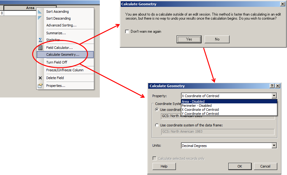
You can calculate the area of polygons, the length of lines, and get the X and Y values for points by using the "Calculate Geometry" tool available by right-clicking on a field column heading in the Attribute table.
It is common to see Lat/Lon or Easting/Northing in attribute tables for point layers. These are not the values used to render the spatial data! These values are not updated when you project, edit, or transform the spatial data! You will need to update these with Field Calculator after changing them.
In lab, we'll use Field Calculator to compute values for attributes. Below are the steps to manually edit the attribute values:
Without an Edit Session - ArcGIS will not track your changes, so "Undo" will not work!
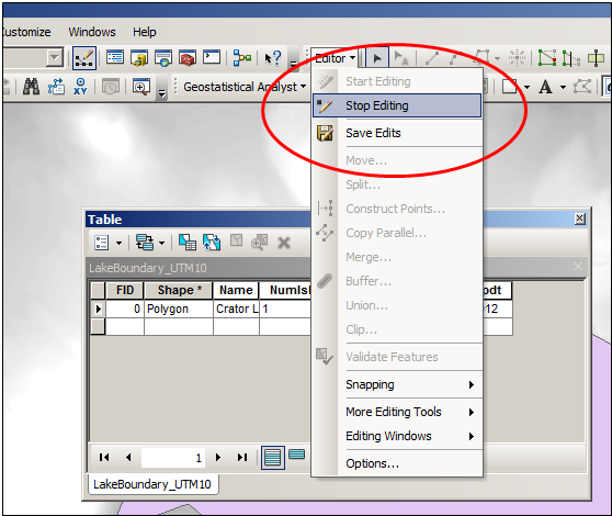
If you do not select "Stop Editing," than your changes will not be saved.
© Copyright 2018 HSU - All rights reserved.